|
Strabon,
a writer of antiquity, describes the borders of the Cappadocian
Region, in his 17 volume book Geographika (Geography-Anatolia XII,
XIII, XIV) written during the reign of Roman Emperor Augustus. Cappadocia
was described as a very large area surrounded by Taurus Mountains
in the south, by Aksaray in the west, Malatya in the east and all
the way up to the Black Sea coast in the north. Through, present
day Cappadocia is the area covered by the city provinces of Nevþehir,
Aksaray, Nigde, Kayseri and Kirsehir. The smaller rocky region of
Cappadocia is the area around Uchisar, Goreme, Avanos, Urgup, Derinkuyu,
Kaymakli and Ihlara.
Volcanic Eruptions and Geological Formations
Mount Erciyes, Mount Hasandag and Mount Göllüdag
were active volcanoes in the geological periods. Alongside with
many other volcanoes, eruptions of these volcanoes started in the
Early Miocene (10 million years ago) and have continued until the
present day.
The lava produced by these volcanoes, under the
Neogen lakes, formed a layer of tufa on the plateaus which varied
in hardness and was between 100 and 150m thick. Other substances
in the layer are ignimbrite, soft tufa, tufa, lahar, asy, clay,
sandstone, marn, basalt and other agglomerates.
Plateaus, having been essentially shaped with
the lava from the bigger volcanoes, were continuously altered with
the eruptions of smaller volcanoes. Starting in the Early Pliocene
Period, the rivers in the area, especially Kizilirmak (the Red River),
and local lakes contributed to the erosion of this layer of tufa
stone, eventually giving the area its present day shape.
-
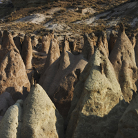
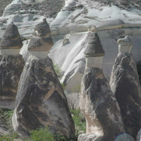
Formation of fairy Chimneys
The
interesting rock formations, known as fairy chimneys, have been
formed as the result of the erosion of this tufa layer, sculpted
by wind and flood water, running down on the slopes of the valleys.
Water has found its way through the valleys creating cracks and
ruptures in the hard rock. The softer, easily erodable material
underneath has been gradually swept away reseding the slopes and
in this way, conical formations protected with basalt caps have
been created. The fairy chimneys with caps, mainly found in the
vicinity of Urgup, have a conical shaped body and a boulder on top
of it. The cone is constructed from tufa and volcanic ash, while
the cap is of hard, more resistant rock such as lahar or ignimbrite.
Various types of fairy chimneys, are found in Cappadocia. Among
these are those with caps, cones, mushroom like forms, columns and
pointed rocks.
Fairy chimneys are generally found in the valleys
of the Uçhisar-Ürgüp-Avanos triangle, between Ürgüp and Þahinefendi,
around the town of Çat in Nevþehir, in the Soganli valley in Kayseri,
and in the village of Selime in Aksaray.
Another characteristic feature of the area are
the sweeping curves and patterns on the sides of the valleys, formed
by rainwater. These lines of sedimentation exposed by erosion display
a range of hues. The array of color seen on some of the valleys
is due to the difference in heat of the lava layers .Such patterns
can be seen in Uchisar, Cavusin / Güllüdere, Goreme / Meskendir,
Ortahisar / Kizilcukur and Pancarlik valleys.
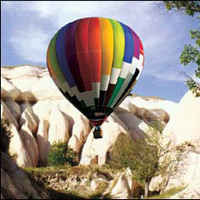
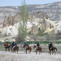
 Click to view the details of Cappadocia Tours
Click for Hotels in Cappadocia
|
 |